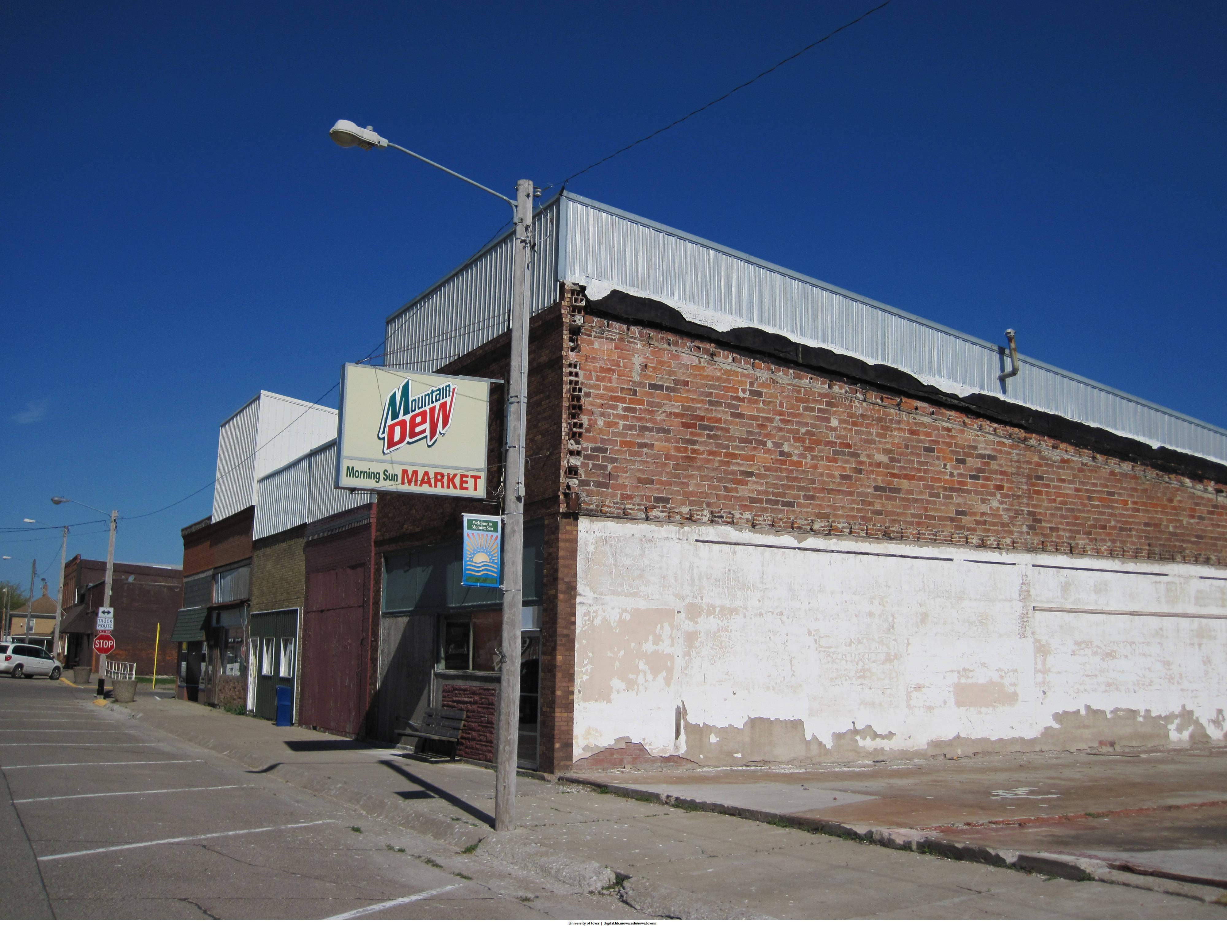
Like most things that wind up being equal parts cool and addictive, Bill Whittaker says his multiyear obsession to photograph Iowa towns began as a fluke.

In July 2007, he was sent to survey a spot for a new cellular tower in Colfax as part of his duties at the University of Iowa’s Office of the State Archaeologist, when a faded advertisement on the side of a brick building caught his eye. He took a handful of photos of that building and the downtown area, hoping to compare his shots with some from when the town was more prosperous.
“I was puzzled that I could find no photos of downtown Colfax on file [at the State Historic Preservation Office], no newspaper clippings, no images in county history books, nothing. It was as if the town had never been photographed until I took those six lazy shots in 2007.”
CREATING A RECORD
After Colfax, Whittaker says he wanted to photograph each town as he traveled. Since a portion of his job is to survey sites for sewer lines, roads and other such development, he had ample opportunity to jump off the beaten path and capture many communities and facilities, some of which no longer stand. One of his early subjects, for instance, was the Old Stone Mill in Spillville.
At that time — the fall of 2007 — the mill had received a preservation grant. Whittaker took numerous photos of the interior and exterior of the building, anticipating using them as a reference once the stabilization of the site was complete. In June 2011, however, the mill was demolished, and Whittaker’s photos are all that remains.
Unfortunately, the mill is not the only building he captured before its demise. He photographed the Brick Arch Post Office in West Branch, which collapsed in 2009, as well as the Green Tambourine building in Keokuk, which also fell down.
His first town, Colfax, flooded in 2010.
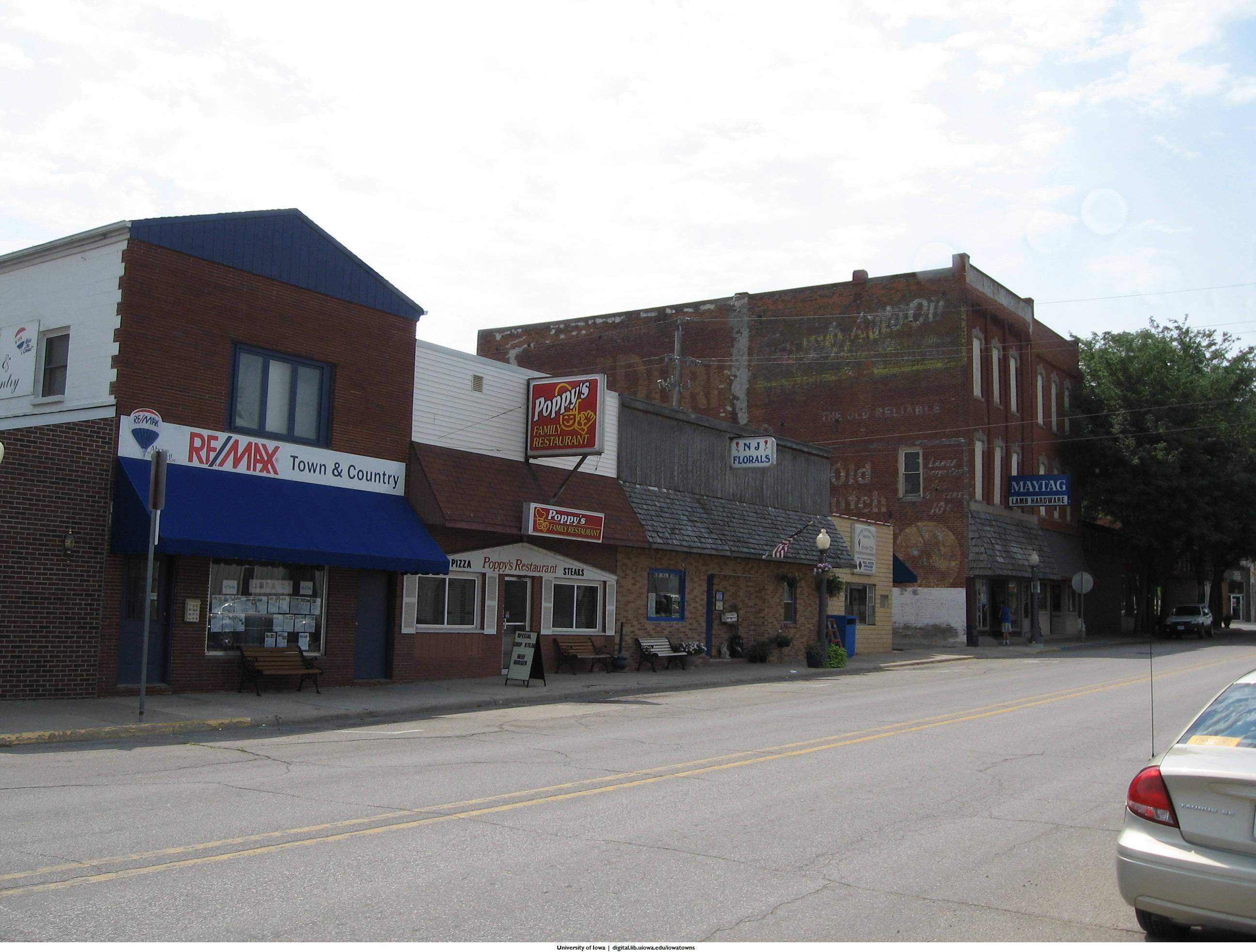
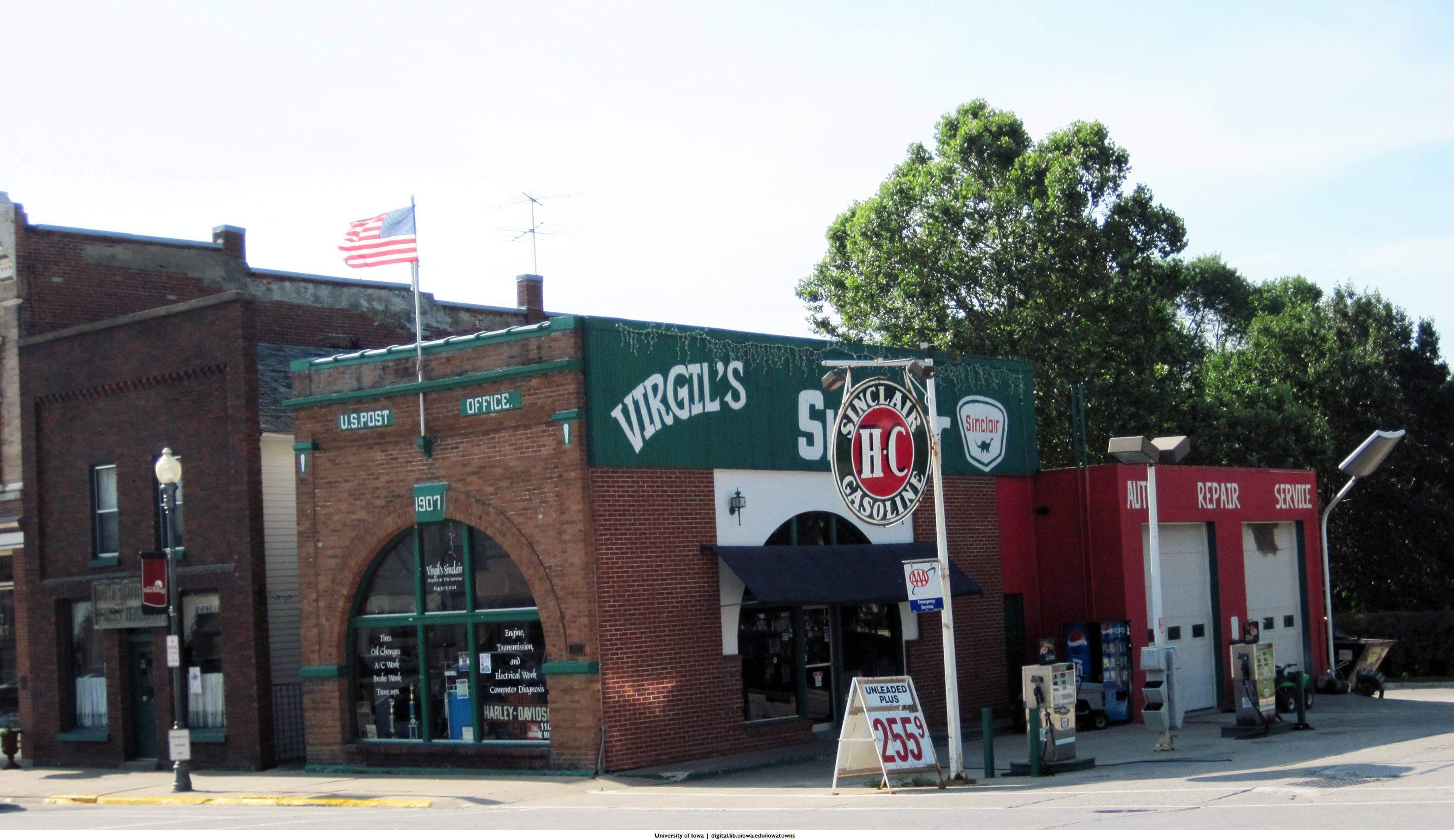
In all, Whittaker took 7,204 photographs of 213 towns in 59 counties between 2007 and 2013. Thanks in part to a grant from Iowa Digital Humanities, the collection, which remains a work in progress, was organized and archived as part of the UI Digital Library. While the collection may sound quite large, Whittaker estimates it reflects less than 10 percent of what could and should be captured.
He’d like to see something similar to a 1938 Works Progress Administration Federal Writer’s Project that would provide an updated systematic survey of towns, culture and history.
“Photographs are invaluable because of the enormous amount of information they contain — how a town looked to its inhabitants, how it was used, its layout,” Whittaker said. “I’ve worked as an archaeologist for two decades. I can tell you that no amount of excavation can equal the information of a good photograph. What if we had photographs of ancient Greek towns before they disappeared? What if we had photographs of prehistoric Indian villages when they were occupied?
“These small towns are long past their prime. Let’s record what’s left before there is nothing left.”
While a statewide project would require a commitment from state officials, Whittaker believes the support is there because “it spans the political divide that separates conservative and liberal; it would document and celebrate rural life; and it would shine a light on huge areas of Iowa that are typically ignored.”
NASTY CYCLE
Whittaker is one of the first to admit he is not a professional or artistic photographer. In his mind’s eye, an imperfect photo is better than none at all.
A few of the photographs he uploaded to Wikipedia were not favorably welcomed by residents of the towns depicted. The community appeared too desolate or forlorn, some argued.
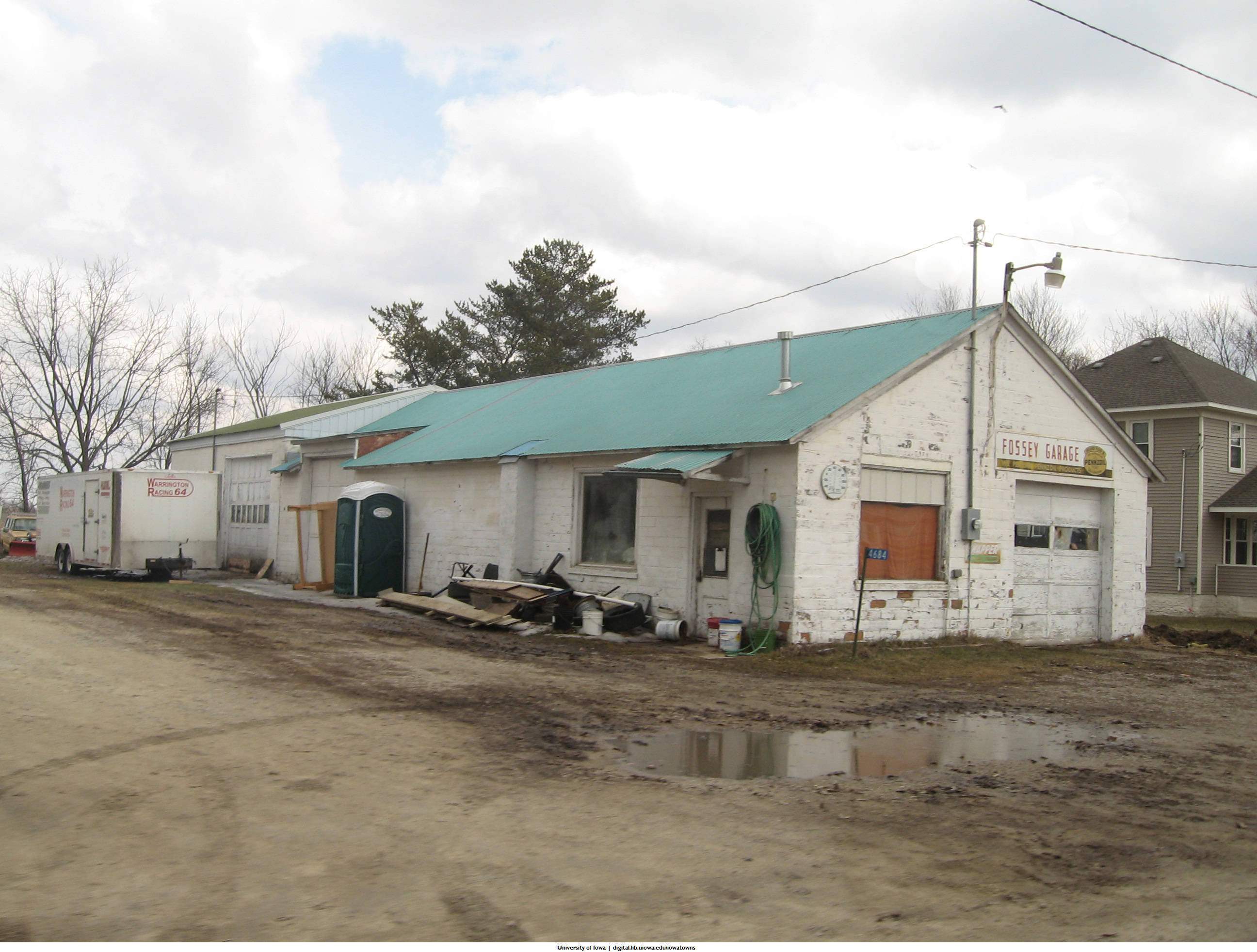
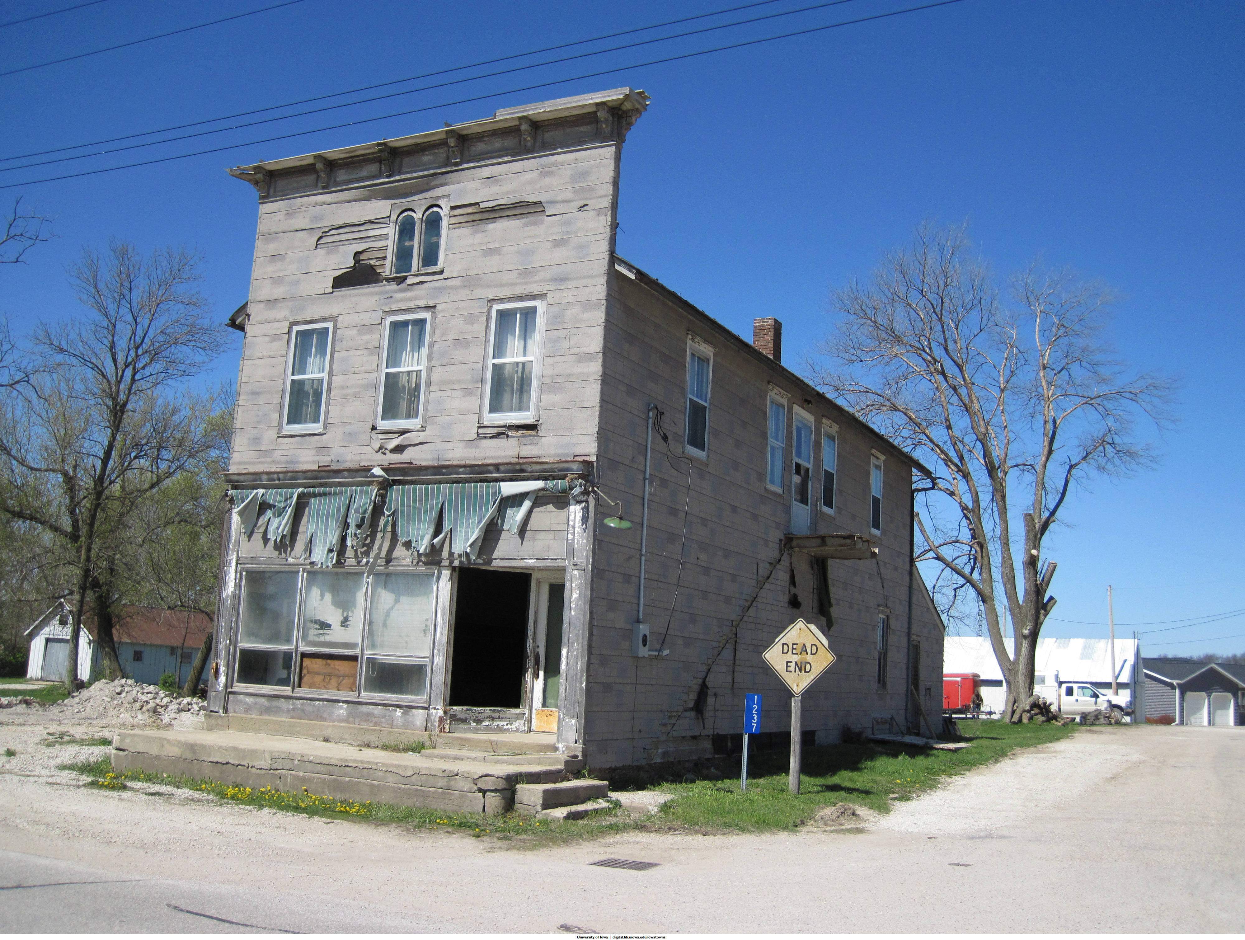
But the truth is that many rural communities are slowly dying due to a host of economic realities and, of course, depopulation. While there are a few photographs of outright ruins in Whittaker’s collection, most are better described as depictions of neglect, which is only getting worse.
“They are going fast, I think the rate of decay has increased, because a lot of these small town buildings were last repaired before the 1980s farm crisis, and we are now at the end of the life span of those repairs. If the roof is not replaced every 20 or 30 years, it will leak. Once the roof has a hole, it takes very little time for the structure to decay.
“Also, no one is doing the nickel-and-dime maintenance that costs little but has to be done at least once a year to keep the structure sound. … Once badly damaged, it cost hundreds of thousands of dollars to renovate a store, it is very hard for owners to justify the cost, and the storefront is soon abandoned, which drags down nearby storefronts. It’s a nasty cycle,” he said.
BUCKING HISTORY
If there is to be any type of turnaround in rural Iowa — and it may already be too late for many communities — residents statewide are going to need to band together and decide what these areas should become.
“The disconnect between landowners and community will grow as more agricultural land is owned by people and corporations who do not live on their farms,” Whittaker said, noting how farming is becoming more automated.
Does a Ringgold County landowner, who makes his/her home in a different state, have a vested interest in the local economy or quality of life? Would such a person care about the Mount Ayr public schools or health care services? Probably not.
The population density of Ringgold County is 10 people per square mile, and the overall population has been on the decline since the 1930 census. But there are significant drops between then and now that are linked to specific economic conditions. For instance, by the 1990 census, after the farm crisis, the county lost more than 2,000 residents, or about 32 percent of its population. Currently, about one-quarter of the people who live in Ringgold County are age 65 and older — same as Monona, Audubon, Dickinson and Calhoun counties. Across the state, about 15 percent of the population is age 65 and up.
“Some small towns will survive, perhaps thrive, if they are in a tourist area or are part of a larger metro area,” Whittaker predicted.
“Do we really need to have highways bypass the center of town? This is probably the quickest way to kill a small downtown, take away its customer base. Do we really need to allow high-density hog confinements everywhere? No one will never build a house downwind from a hog lot.”

This column by Lynda Waddington originally published in The Gazette on June 9, 2014. Photo credit: William Whittaker, Office of the State Archaeologist, University of Iowa